Mountainous topography offers breathtaking scenery, a quaint environment and opportunities for outdoor adventures, making it an appealing choice for individuals who value these benefits.
However, hilly topography presents specific challenges, especially in seismically active regions like Nepal. Nestled deep within the Himalayas, Nepal is accustomed to powerful earthquakes that shape and contribute to its dramatic landscapes.
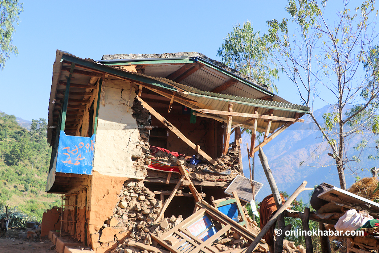
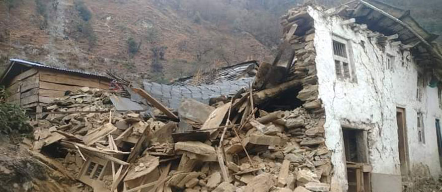
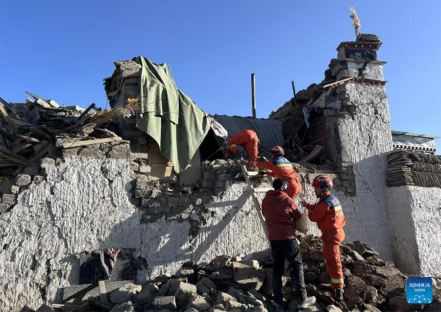
Recent examples of seismic hazards associated with hilly terrain can be seen in the 6.4-magnitude earthquake that recently struck Jajarkot and Rukum West killing 153 people and leaving thousands without a roof over their heads.
Officials at the National Earthquake Monitoring and Research Centre have determined that the epicentre of the recent quake was Ramidanda in Jajarkot. This finding highlights the vulnerability of hilly terrains to seismic activity. Earthquakes occur due to the dynamic movement of tectonic plates, and seismic energy is released when accumulated stress is rapidly released. It is important to understand the distinction between intensity and magnitude in assessing the impact of earthquakes.
Understanding earthquake

The moment magnitude scale (Mw) and Richter scale are two regularly used scales for assessing the magnitude, which provide a universal measure of the earthquake’s size by quantifying the total energy produced at the source.
However, intensity, which is determined by applying the Modified Mercalli Intensity (MMI) scale, describes how an earthquake affects a certain area locally and regionally. It offers crucial information for assessing structural and sociological ramifications that are specific to certain locations.
The converging border of the Indian and Eurasian tectonic plates places Nepal’s hilly areas in earthquake-prone areas. Large tectonic forces are created when these two large plates collide and interact, which frequently causes seismic activity and earthquakes in the area.
Seismic events in these regions have the potential to be catastrophic, resulting in landslides and avalanches that seriously harm infrastructure and destroy lives. The vulnerability of structures constructed on sloping terrain is one of the most significant issues in hilly and seismically active areas.
People residing in these hilly regions may face serious challenges as a result of the potential of earthquakes to cause destruction and disruption. Uneven terrain might make earthquake-resistant structures more difficult to construct.
To maintain stability during seismic occurrences, hillside construction frequently requires specific engineering and foundation designs. It might be difficult for locals to ensure that their structures are secure because these extra precautions can be costly and time-consuming.
Apart from soil, other geological elements and features of the terrain can have a substantial impact on the amplification or attenuation of seismic waves. One important factor that can either increase or decrease the impact of amplification is the soil type.
During an earthquake, loose, unconsolidated soils such as sands and silts tend to magnify ground motion, whereas more compacted soils or bedrock may reduce shaking, and the geological composition of the subsurface, particularly different types of rocks and their porosities, may significantly impact how seismic waves behave.
Dense solid bedrock can reduce shaking, whereas highly broken or porous rocks can worsen it. Natural topography characteristics such as valleys, hills, and basins can either amplify or reduce seismic wave velocity, affecting ground shaking in certain places.
Topographic amplification of earthquakes

The term —topographic amplification of earthquakes— refers to how the terrain may cause earthquakes to feel stronger in specific areas and weaker in others. Consider hills and valleys that intensify or dampen shaking during an earthquake.
The behaviour of seismic waves can be modified by the natural topography of an area, which can amplify or weaken them as they move through various soil types. In terms of topographic amplification, it is important to deal with intricate geological conditions that involve numerous rock and soil types.
The behaviour of seismic waves is significantly influenced by these basic ground parameters. In addition, we must recognise the significant impacts of topographical features, including canyons, cliffs, gullies, ravines, basin borders, hillcrests, ridges, and valleys.
The presence of surface topographic irregularities, including such features, has topographic effects on seismic waves. Seismic waves are greatly altered by these topographic features as they move across altered terrains.
The phenomena of topographic amplification of seismic waves, which are impacted by Earth’s surface characteristics, including mountains, ridges, and valleys, bring about noticeable changes in ground motion that affect the severity of damage in various areas.
The topography of a particular area, such as slopes or hills, can have a considerable impact on seismic wave propagation and amplification.
Significantly, high terrain, such as mountains and ridges, intensifies ground tremors, whereas lowlands may undergo de-amplification owing to the topography’s reflecting and dispersion properties.
Additionally, topographic site impacts are influenced by the incident direction of seismic waves and affect the amount of amplification or de-amplification. Furthermore, given that ridges concentrate seismic energy and have the potential to cause catastrophic landslides, it is of the utmost importance to recognise the significant role of topographic amplification in the initiation and progression of landslides remains imperative.
Extensive earthquakes in hilly areas and way out

The effects of earthquakes in hilly areas are more extensive than just ground shaking and building integrity, given the intricate relationships between seismic forces, topography, and geological elements.
Large differences in the soil’s condition can occur in hilly places, and these differences directly impact how seismic waves behave. This intricate knowledge is crucial for improving seismic hazard assessments and for guiding durable structural design procedures.
Earthquakes could move rocks and soil, causing them to slide down slopes. The hilly topography may make it more difficult to evacuate during an earthquake. Narrow, winding roadways that straddle hillsides may get damaged or blocked during an earthquake, making rescue and relief efforts more difficult.
Emergency response teams need to be prepared and evacuation routes need to take into account the logistical challenges that high terrain presents. Knowledge of the local geology is necessary for accurate risk assessment and construction techniques.
The combination of thorough strategy, engineering expertise, and community awareness is required to build resilience in these spectacular environments. Retrofitting existing structures to comply with earthquake-resistant standards on sloping terrain is a significant financial burden because extensive adjustments are required.
To preserve the area’s natural beauty and ensure the safety of the local population, construction in hilly areas must consider ecology. It is difficult to balance environmental protection and earthquake safety.
In conclusion, cooperation between the local community, the government, and earthquake engineering specialists is required to solve the complexity of earthquakes in hilly, seismically prone areas. By acknowledging the unique challenges and taking the necessary precautions, we can appreciate the beauty of these settings while being prepared for the seismic forces below.


